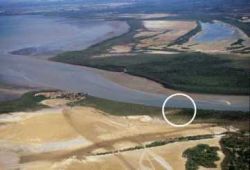
POSITIONING
CRITERIA
-
Shortest access to deep waters
yet avoiding the denser mangrove fringe requires
analysis of bathymetry and ground survey data compilation.
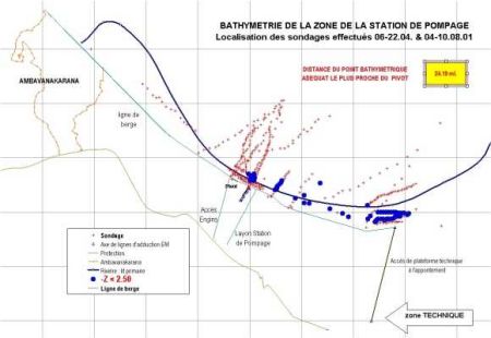
Mapping the river and shoreline
using combined XY data from GPS and Z from echosounder
readings. Results downloaded to automated spreadsheet
showing all points at or below a specified depth
[above : blue dots at Z <= -2.50 m.] and the
distance between the closest of those to the pivot
point, determined on the land by the adequacy of
its overall accessibility to the discharge box and
supply canal .
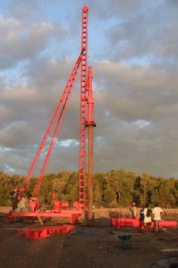
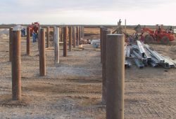
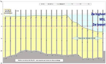
FOUNDATIONS
-
Concrete column poured in steel
piping piled down to the rocky [pelite] platter [averaging
15.94 m. below the ground level]. Poles horizontal
grid 4.00 x 3.50 m. Section perpendicular to shore
represented below :
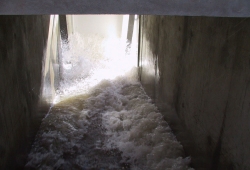
FLOW
CAPACITY : the
discharge box is built to accomodate up to 6 pumps
of 3.6 m3/ sec. nominal capacity each . Initial
laying of 3 adduction lines to operate the first
200 ha. of ponds .
Ready to run First wave in
30 Nov.2001 15:30
 
 Contact
us for more info Contact
us for more info
|